Where is Sand Wash Basin Located?
The Sand Wash Basin HMA (Herd Management Area) is located in the northwest corner of Colorado, about 48 miles west of Craig, Colorado. It is public land managed by the BLM, Bureau of Land Management.
Driving Directions
Heading west out of Craig, follow Hwy 40 for 30 miles to the town of Maybell, Colorado. Just west of Maybell turn northwest (a right turn) to Hwy 318 for 17 miles to the entrance of Sand Wash Basin. Turn north on Moffat County Road 67 into the HMA. Coming from Utah on Hwy 40, you would turn northwest (a left turn) to Hwy 318 for 17 miles to the entrance of Sand Wash Basin. If coming from the west on Hwy 318 the entrance is about 43 miles from the Utah state line. For first time visitors it is recommended to follow the "Wild Horse Loop" marked in red on the map. Scroll to the bottom of this page to view and navigate the Google map.
Road Conditions and Precautions
All the roads within the HMA are gravel, dirt and sand. Some roads have a fair gravel base, but many do not. No culverts in the basin, so you will be driving through several "washes." A high clearance 4x4 vehicle is recommended. Any type of moisture (rain or snow) can make the roads extremely slippery and impassable. Do check weather forecasts before heading to the basin, even heavy rains from the previous day or two will affect the condition of the roads. This area is remote, and cell service is spotty at best. Come prepared with water and essentials, and most importantly a good spare tire.
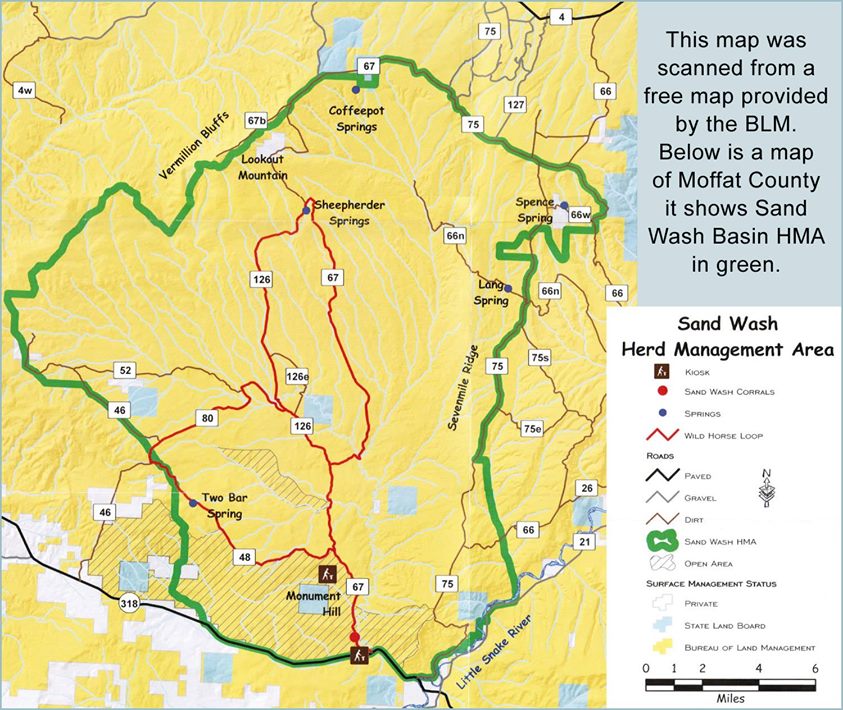
The map was scanned from a free BLM brochure available at the local BLM office, brochure racks, Craig Chamber of Commerce or Moffat County Tourism. Click map to enlarge.
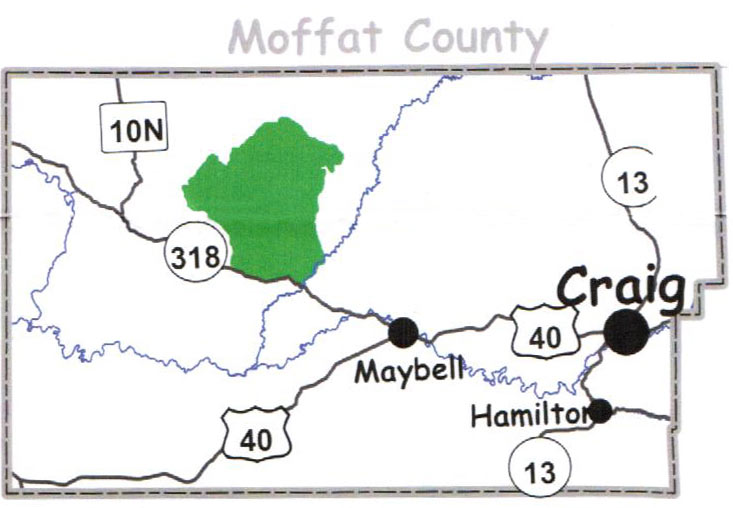
Moffat County is located in the northwest corner of Colorado, Sand Wash Basin is shown in green on the above county map. Click map to enlarge.
Wild Horses of Sand Wash Basin in Northwest Colorado
Contact Us
To contact us, please visit the Sand Wash Basin Facebook page.
2026 © All Rights Reserved. RiderWeb, Inc.